Craggy Gardens
The whole recreation area around milepost 364 on the Blue Ridge Parkway: visitor center, picnic area, two trails, the heath balds.
It's the name people search. It is not one spot.
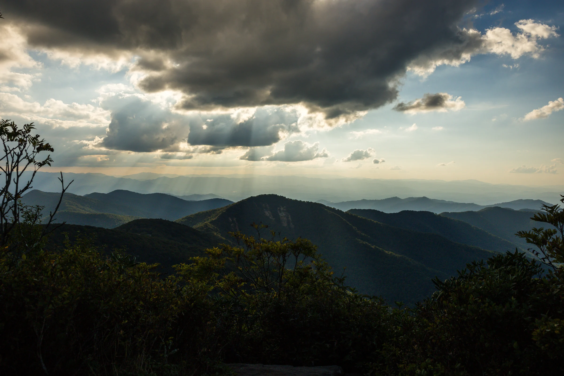
Blue Ridge Parkway · Milepost 364.1 · 40 minutes from Asheville
The three spots on Craggy Pinnacle, and when you'll have one to yourself.
We've photographed proposals on this mountain for sixteen years, at sunrise, at sunset, in rhododendron season and in fog you could lean on. This is everything we tell couples on the planning call, plus a tool that shows what the mountain will be doing on your date. Every proposal we photograph includes video, and your photos are delivered within 48 hours.
Written and photographed by Will Thomas. Conditions and access notes checked September 2026.
The short version
Start here
The names get mixed up constantly, in guidebooks, on Google Maps, and by locals who've been coming here for decades. We did it ourselves for years. So before anything else, here's the map in words.
The whole recreation area around milepost 364 on the Blue Ridge Parkway: visitor center, picnic area, two trails, the heath balds.
It's the name people search. It is not one spot.
The 5,892-foot summit with the stone-walled overlook. The Craggy Pinnacle Trail climbs it from the parking lot at milepost 364.1.
This is where proposals happen. All three spots in this guide are on this trail.
The parking lot for the Pinnacle trail, named for the peak across the road, not the one you're climbing.
Type "Craggy Dome Overlook" into your maps app and you'll park in the right place.
The trail-less, rhododendron-covered peak you can see from the Pinnacle. Just over 6,000 feet, the highest point in the Craggies.
Not a proposal spot. Worth knowing, since you'll be looking at it. More below.
Milepost 364.4, on the Asheville side of the tunnel. Restrooms in season, exhibits, and the start of the Craggy Gardens Trail to Craggy Flats and Craggy Knob.
Backup parking and a good stop for the nervous partner who needs a minute.
The grassy bald with the stone shelter, on the Craggy Gardens Trail.
The only place in the area the Park Service permits a ceremony. Proposals don't need one.
The one thing to remember
Park at the Craggy Dome Overlook, walk the Craggy Pinnacle Trail, and you're in the right place. Everything on this page is about that one trail.
Quick answers
Short versions here; the long versions are further down the page.
Sunrise on a weekday, at the summit or the west ledge. Second best: a weekday sunset on the west ledge, which holds one couple and gives you fair warning when someone's coming up the trail.
Short and rocky. If you're in good shape, be at the lot 20 minutes before your proposal time. If you don't hike much, give it 30 to 45 minutes. If you'd rather take it slow, an hour gets you to the top with time to catch your breath. Julie goes over the whole walk with you on the planning call.
Not for a proposal with eight or fewer people on the trail with hand-carried gear. That's Park Service policy since 2025, and we carry our own commercial authorization for the photography.
As of September 2026, yes. The Parkway is open from Asheville to Mount Mitchell. The picnic area is still closed for Hurricane Helene repairs, and the Parkway north of Mount Mitchell is closed. Check the Park Service road page the morning of.
Wait 20 to 30 minutes first. The wind up here moves cloud fast and the view often opens. If it doesn't, we drop down the Parkway to a lower overlook that's under the cloud deck. We've done this many times.
Figure 10 to 15 degrees cooler than Asheville, more with wind. In summer that means a light jacket at sunset. In October it means a real one.
Text it to Julie and she'll tell you which spot and which hour before you've finished your coffee.
Look around first
We shot this 360 tour at sunrise, so the light you see is morning light. Every scene is a place you can stand. Use it to pick your spot, to plan where the two of you will be facing, and to show your photographer exactly what you're picturing.
If the tour doesn't load in your browser, open it in a new tab.
Pick your spot
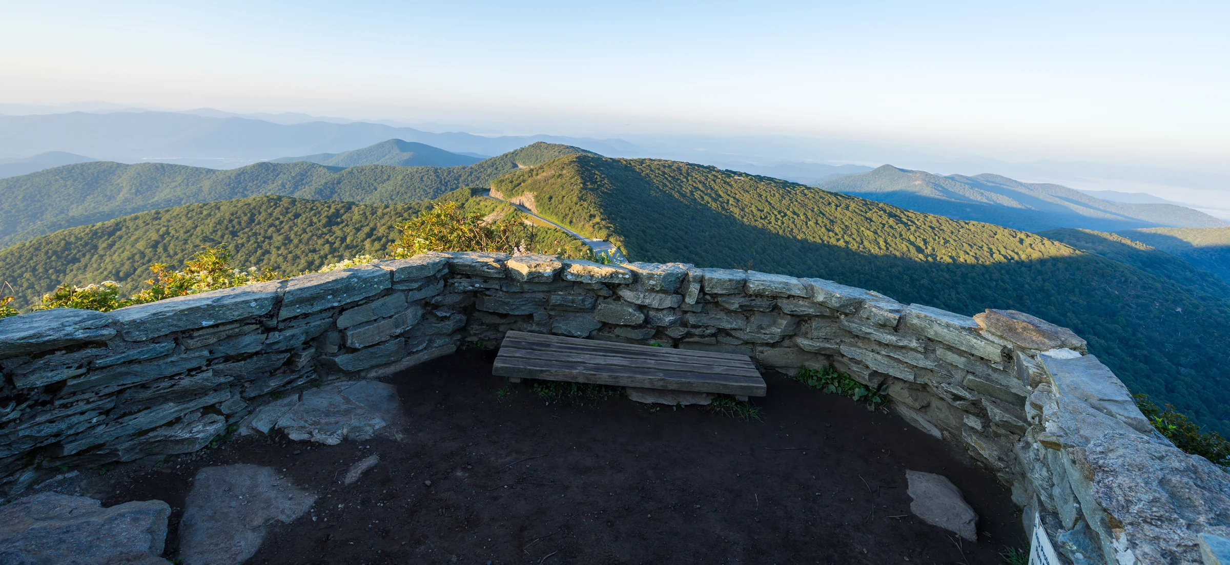
Most people think of Craggy Pinnacle as one place: the summit wall. It's actually three places on one trail, and they behave differently at different hours. The trail splits at a junction sign a few minutes below the top. Left climbs to the summit. Right goes to the lower overlook. And just past a wooden bench, a right turn leads to a west-facing ledge that most visitors walk right past.
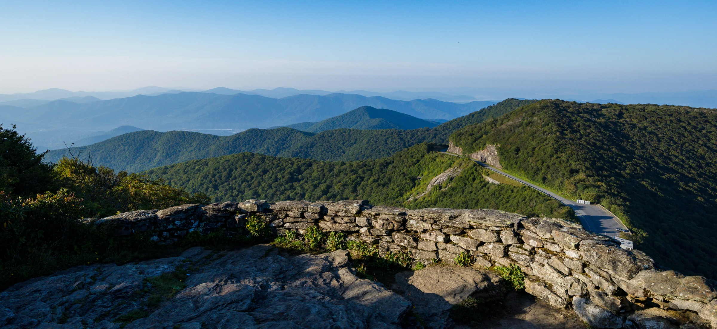
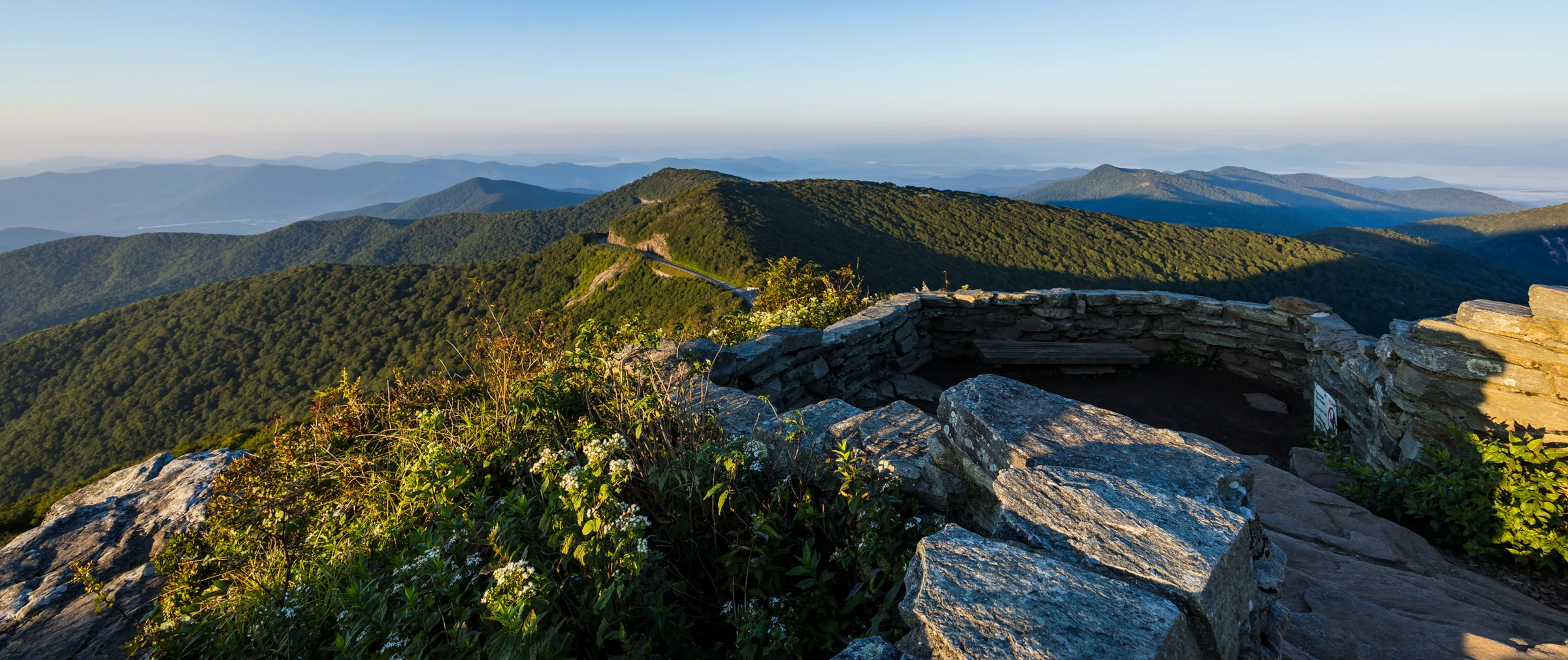
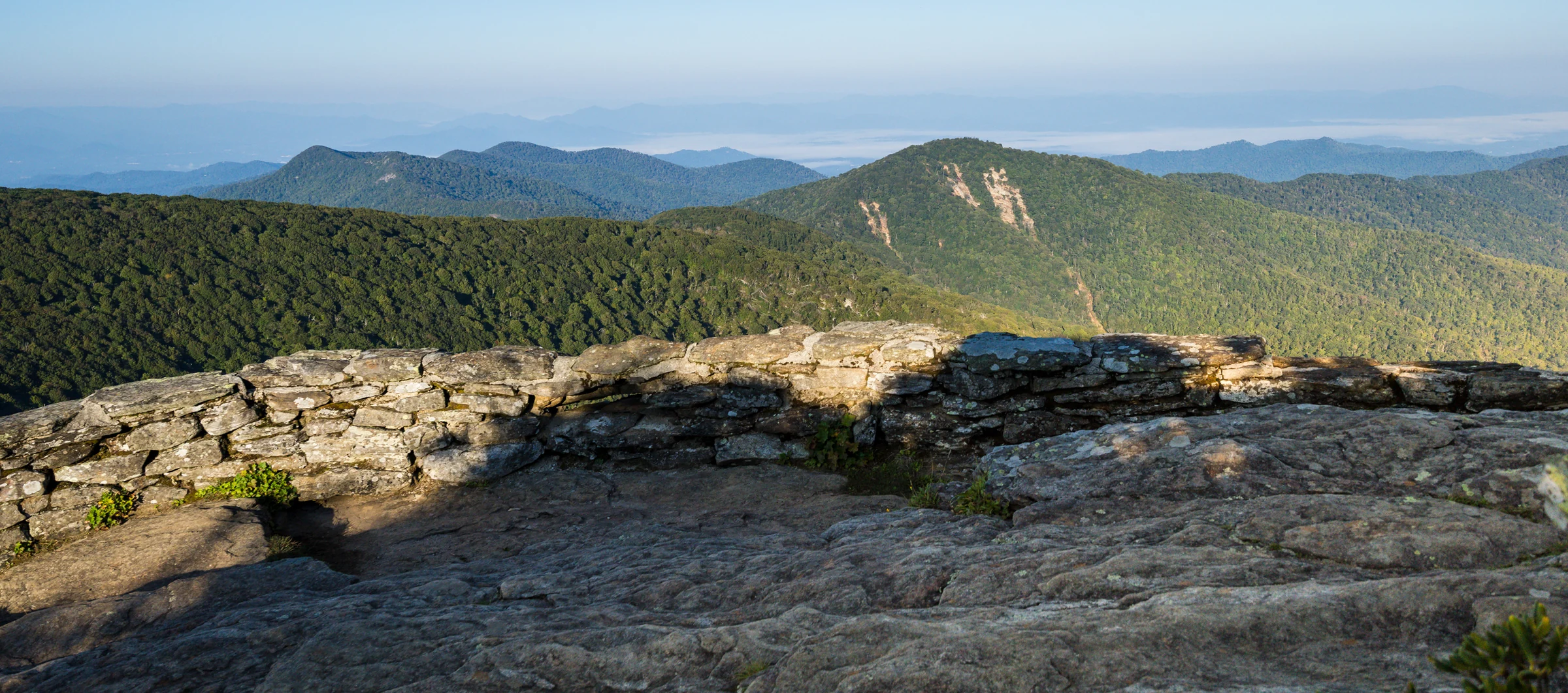
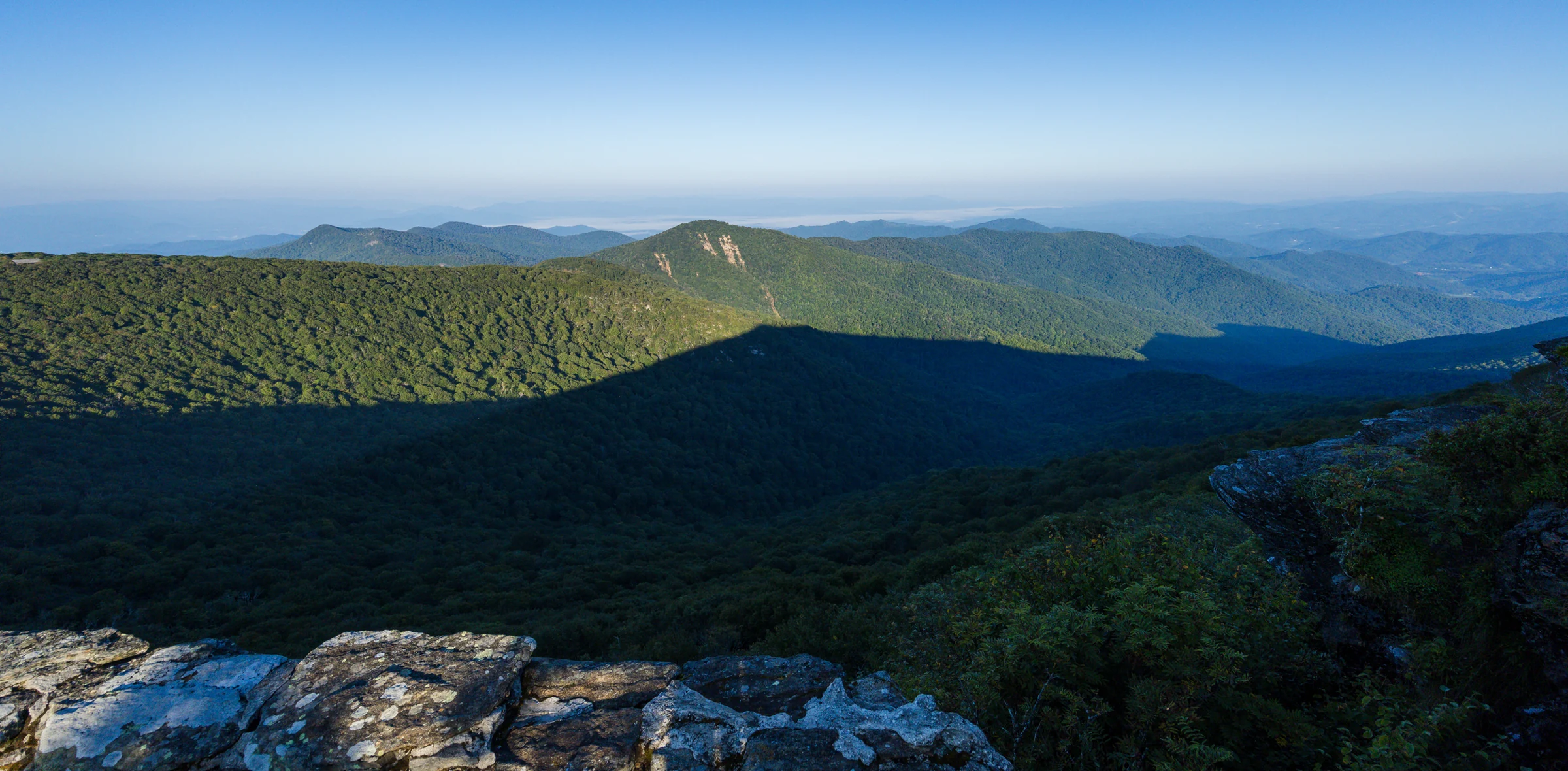
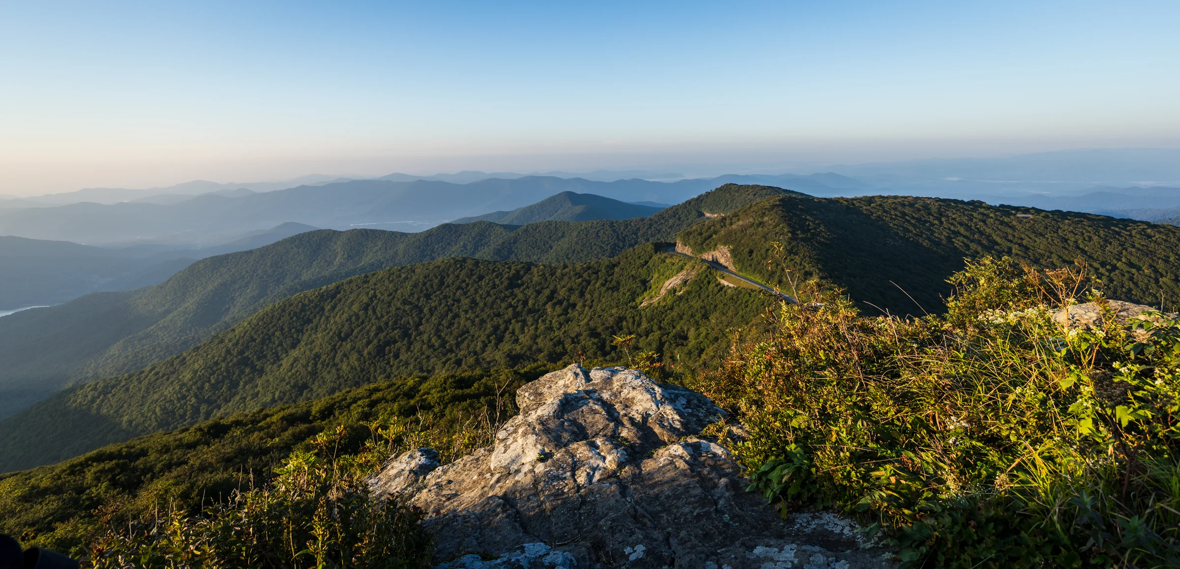
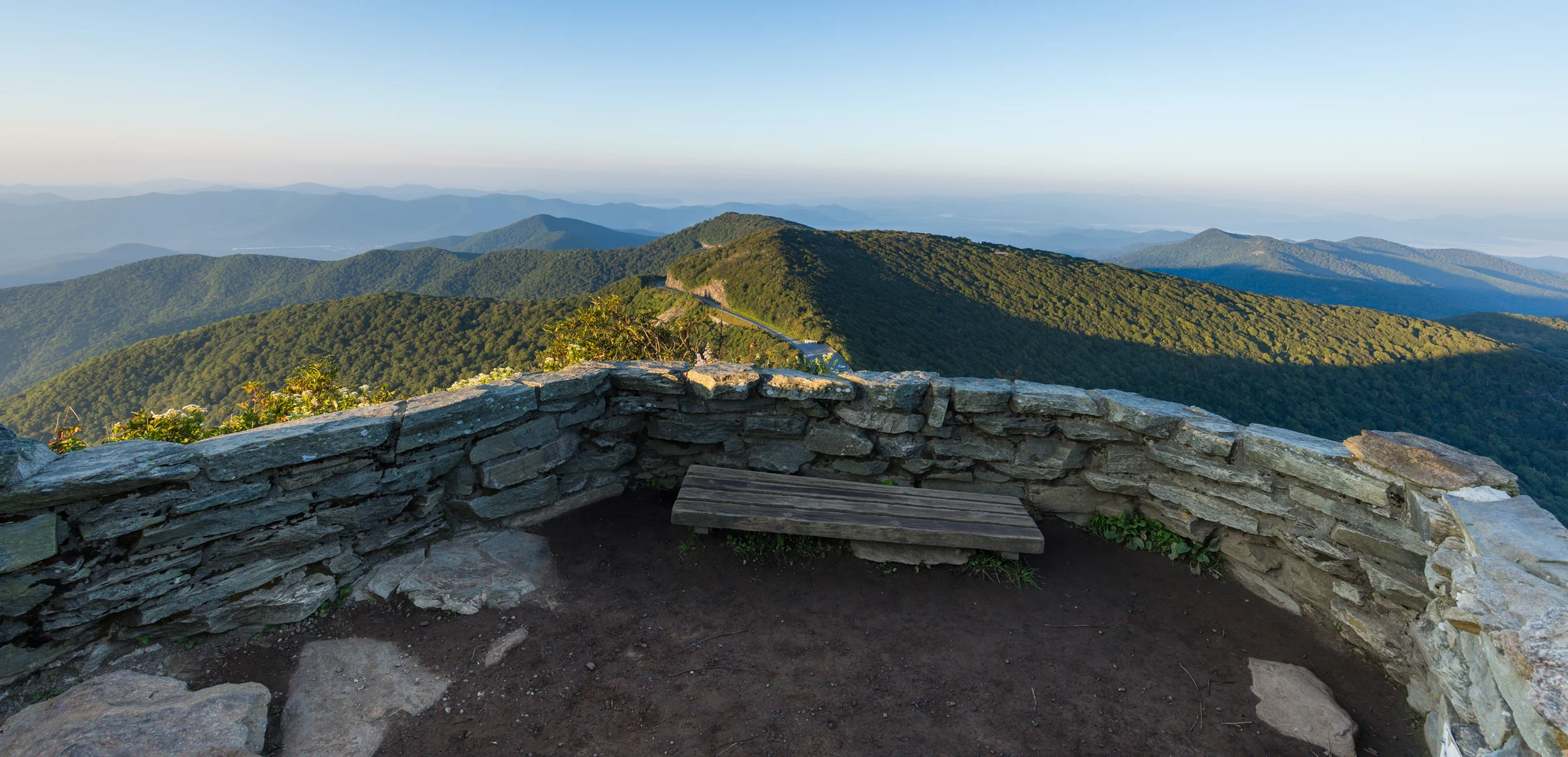
The classic. A stone-walled overlook with the Black Mountains and Mount Mitchell to the northeast, the Asheville watershed reservoir below, and ridgelines fading into Tennessee to the west. On an inversion morning the valleys fill with cloud and you're standing on an island.
For a proposal, the summit works best when it's yours, which means sunrise, and ideally a weekday. The wall is compact, so at a busy sunset the crowd gathers on the exact stretch of wall where you'd want to kneel. The tour splits it into four sections; the far side, past the steps, is where we usually work because it puts the sun and the long view behind you.
What to know: the last stretch is stone steps. In a dress or slick-soled shoes, take them slowly. It's windy up here almost always.
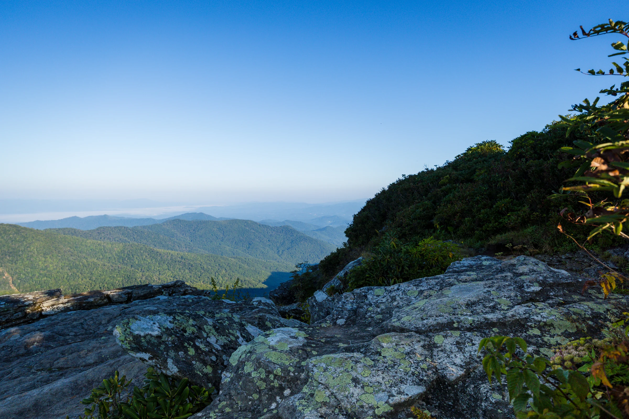
Take the right fork at the junction sign and you reach a lower overlook with a handful of framings: ridges to the south, the visitor center side, and a couple of rock positions that keep the trail out of frame. When nobody else has found it, this is the quietest of the three, and it's the spot we suggest for couples who want the view without the summit's audience or the summit's steps.
Because it offers more than one angle, it's also the most forgiving spot for light. If the sun is harsh from one direction, we move you ten feet and change the whole picture.
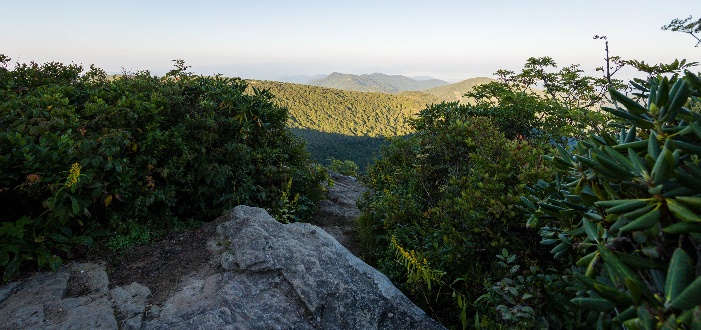
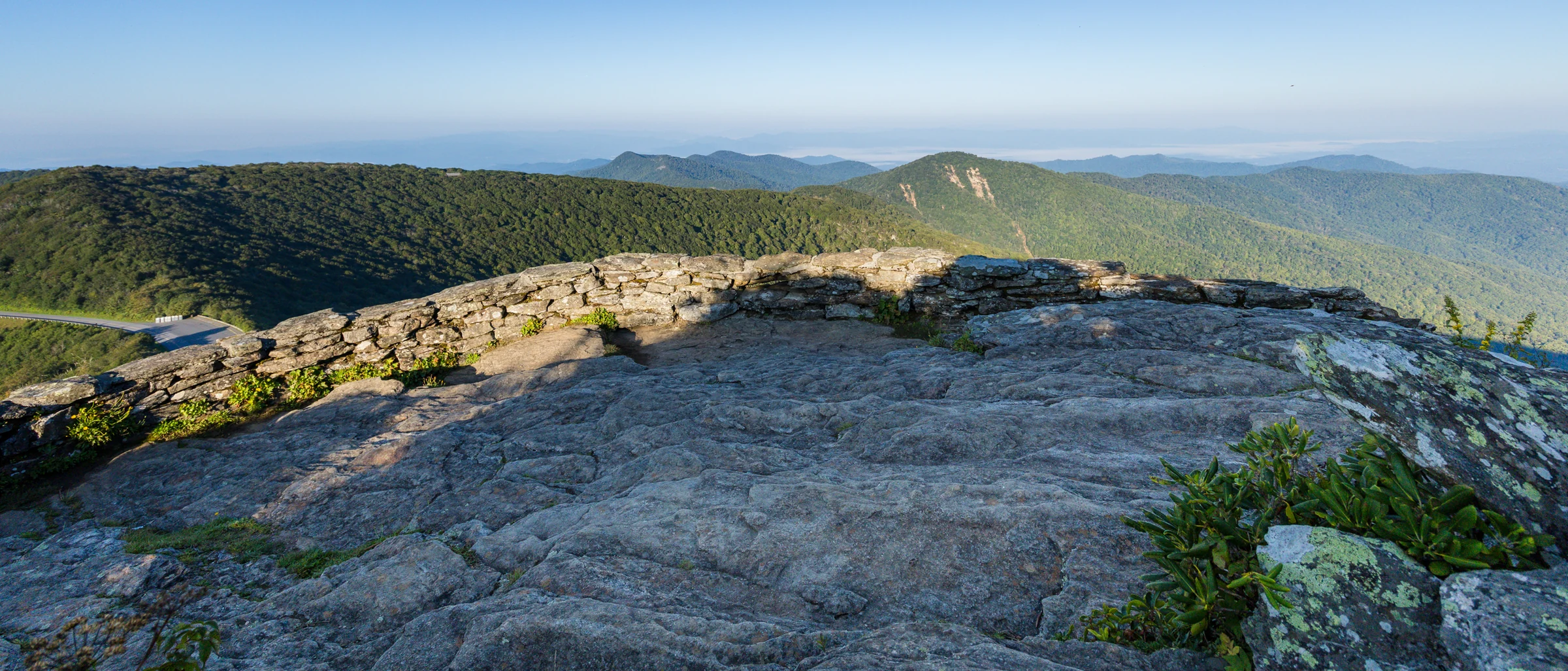
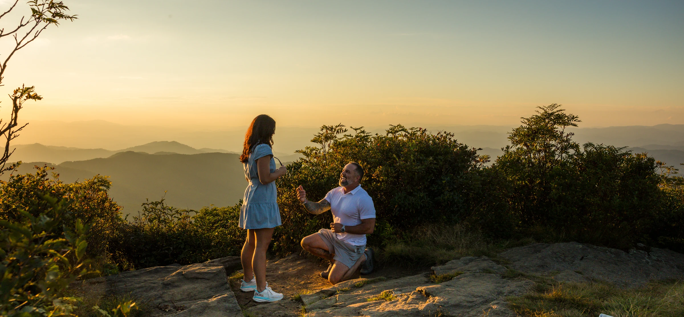
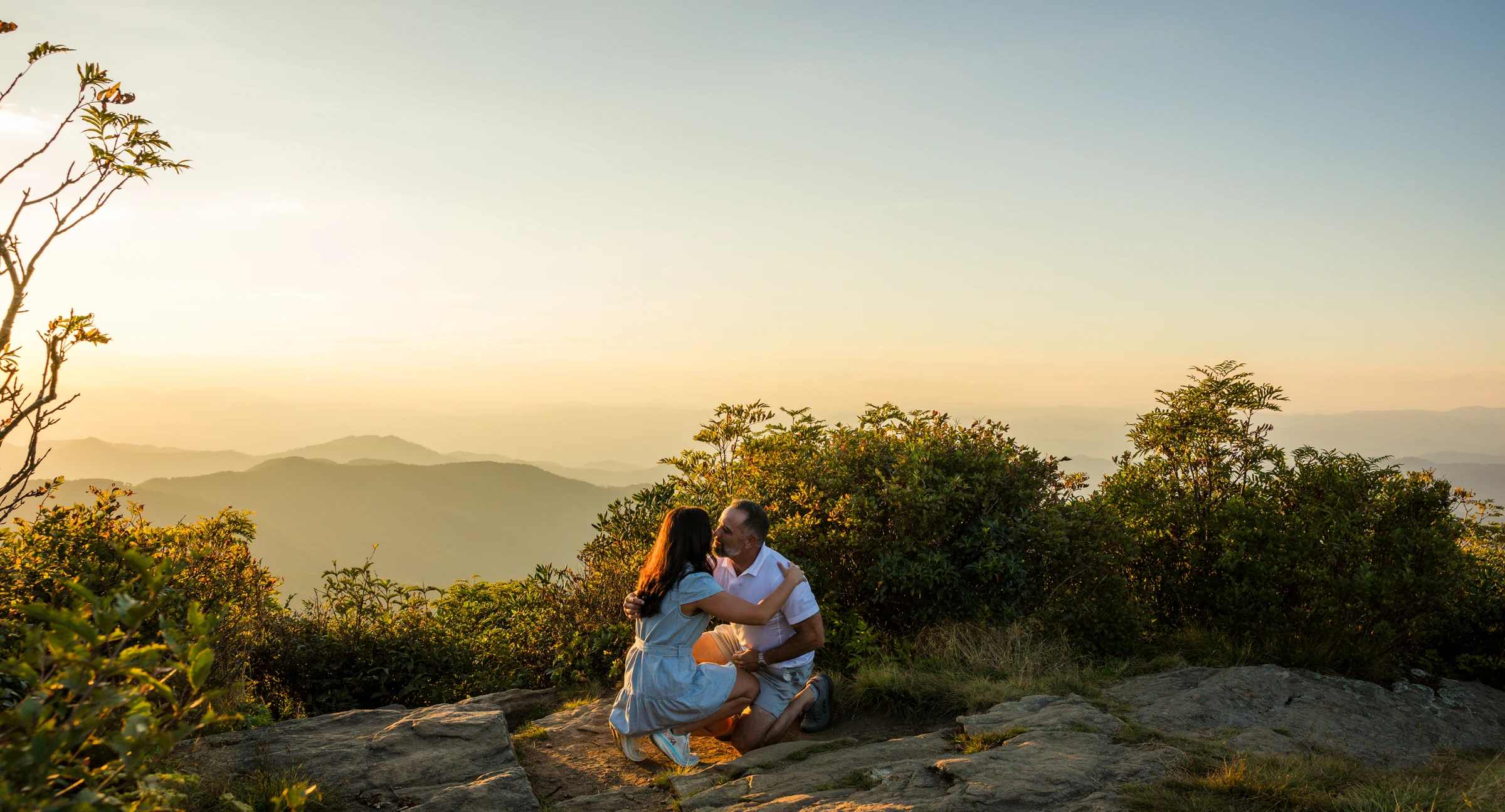
Turn right at the wooden bench and the trail flattens out into a short, sandy dirt path. It ends on a rock ledge that faces almost due west, into the sunset. The rock itself is wide, 20 or 30 feet in places, but the part with an open view is a window between rhododendron and blueberry about six or seven feet across. One couple fits. If it's taken, it's taken, which is exactly why it's worth arriving early.
This is the spot we used for our most recent proposal here. The drop off the front is about six feet into rhododendron so dense it would catch you; the plants would do more harm than the fall. You can't hear the summit crowd from here, but you can hear footsteps on the trail before anyone appears, which is the kind of warning a surprise needs.
The ledge's sunset behaves differently by season, and that's what the date tool below is for. In mid-September the sun drops straight down the middle of the window. In June it sets well to the right, behind the blueberries, and rakes the couple with side light instead. In December it's gone to the left. All three can work; they just look different.
There are a couple of short side paths off this ledge, 15 feet or so to smaller rocks. They're fine for engagement photos and wrong for a surprise proposal, because there's no room to hide a photographer.
Which one is yours?
Sunrise people and inversion chasers: the summit. Couples who want privacy and a soft, flexible light: the lower overlook. Sunset people who want the sun in the picture: the west ledge. We'll help you choose on the planning call, and we scout the morning of.
The real question
Here's the straight answer for each spot, from a lot of mornings and evenings on this trail.
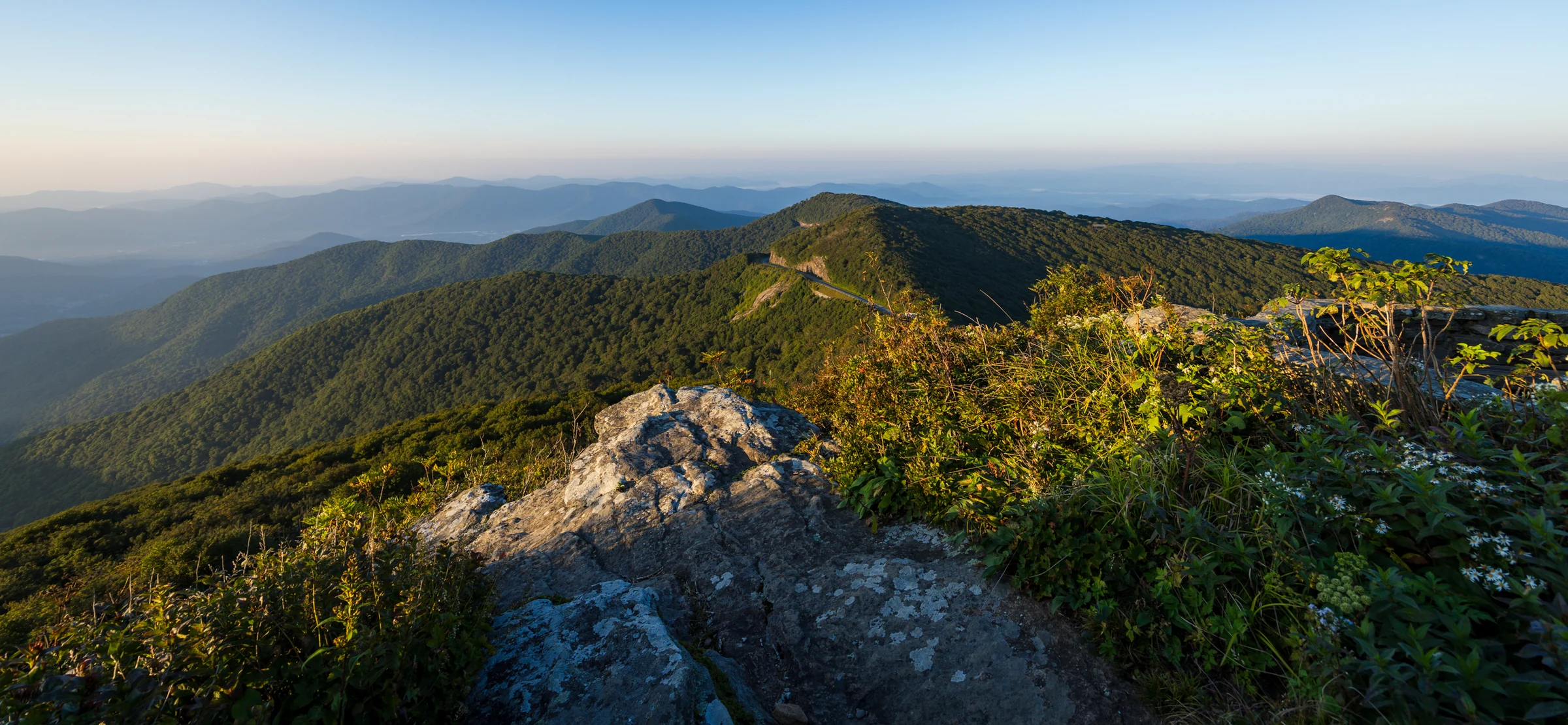
Two more things that matter. Since the Parkway reopened after Hurricane Helene, the whole area has been quieter than it was in the years before, and it's stayed that way through 2026. And a private proposal is mostly about arriving early and knowing which fork to take, which is the part we handle.
Choose the light
Both are good here, and the honest answer depends on what you want in the photo and how early you can get your partner out of bed.
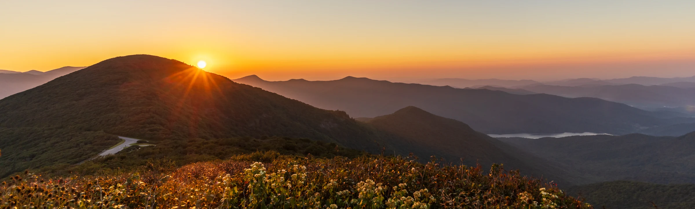
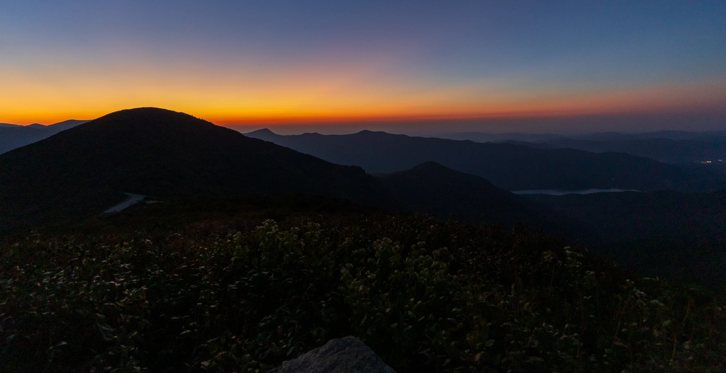
If you're still deciding, the question we ask is: do you want the sun in the picture, or the cloud in the valley? Sun in the picture is the west ledge at sunset. Cloud in the valley is the summit at sunrise.
Your date
Pick a date and we'll show you sunrise and sunset, where the sun lands on the west ledge, what's blooming or turning, and how crowded to expect it. Bloom and berry windows come from dated records on this mountain going back to 2018 plus our own visits, and they repeat year to year; cloud and crowd odds are our working estimates by month, not a forecast. Julie looks at the actual forecast with you the week of.
Dots show when each is likely; dark dots are the prime window. Rhododendron and mountain ash come from dated records 2018 to 2026; the rest from our own seasons on this trail.
| What's showing | Jan | Feb | Mar | Apr | May | Jun | Jul | Aug | Sep | Oct | Nov | Dec |
|---|---|---|---|---|---|---|---|---|---|---|---|---|
| Parkway gate usually open | gate usually closed | gate usually closed | gate usually closed | likely | prime window | prime window | prime window | prime window | prime window | prime window | likely | gate usually closed |
| Catawba rhododendron | no | no | no | no | likely | prime window | no | no | no | no | no | no |
| Flame azalea | no | no | no | no | likely | prime window | no | no | no | no | no | no |
| Mountain laurel | no | no | no | no | likely | prime window | no | no | no | no | no | no |
| Ripe blueberries | no | no | no | no | no | no | likely | prime window | likely | no | no | no |
| Mountain ash berries | no | no | no | no | no | no | no | likely | prime window | prime window | likely | no |
| Fall color | no | no | no | no | no | no | no | no | likely | prime window | no | no |
| Inversion mornings | no | no | no | likely | prime window | prime window | likely | likely | prime window | prime window | likely | no |
| Busy weekends | no | no | no | no | likely | prime window | likely | likely | likely | prime window | no | no |
Weather
Craggy sits nearly 3,800 feet above downtown Asheville, and moist air lifting up out of the French Broad valley has to cross this ridge. That's why the Craggies sit in cloud more often than Black Balsam or Max Patch, and it's also why the good mornings here are better than anywhere else on the Parkway.
Two very different things get called "fog," and it's worth knowing which one you're looking at.
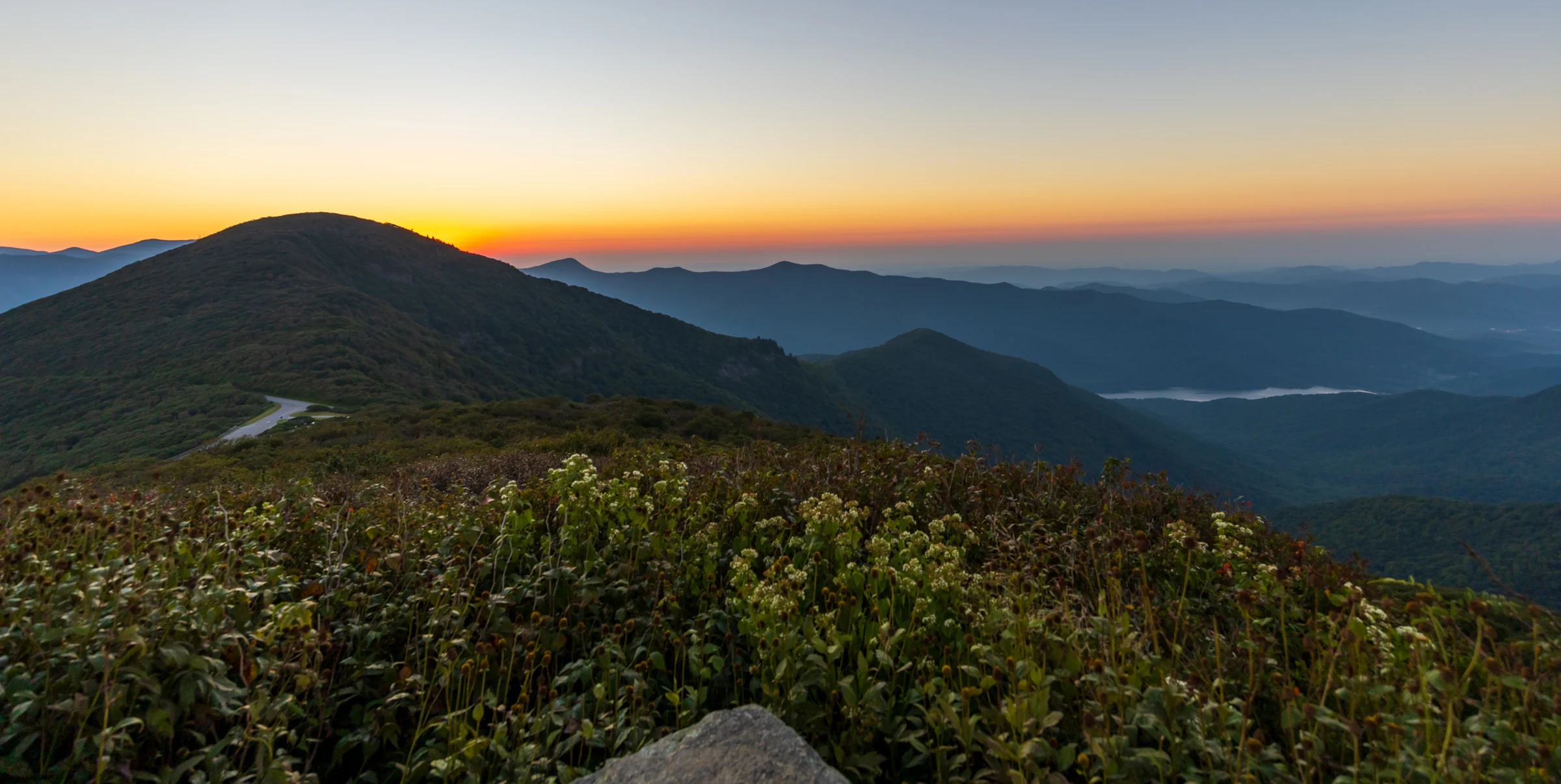
The cloud deck is at, say, 5,000 feet, so Asheville is clear and sunny while the summit is inside the cloud. Visibility drops to a few dozen feet, everything is wet, and the wind makes it feel colder than the thermometer. Roughly one visit in five or six runs into this at some point. It rarely lasts all morning. Wind moves cloud across this ridge fast, and if you wait 20 to 30 minutes at the wall you'll often watch a window open, then close, then open wider. When it settles in for real, we move you down the Parkway to an overlook below the cloud deck and finish there. Nobody goes home without photos.
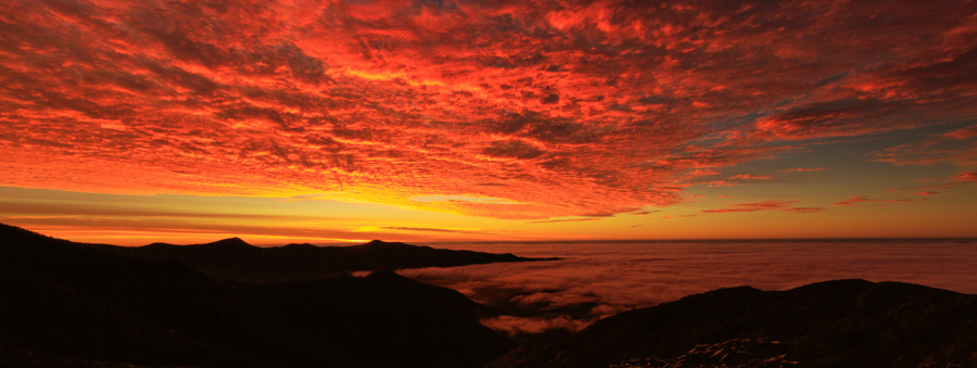
After a clear, cool night, cold air pools in the valleys and cloud forms below the summit instead of on it. From the wall you're looking across a white sea with the Black Mountains and the Craggies standing out of it, and as the sun climbs the whole thing burns off from the top down. It happens most in May and June and again in September and October, on high-pressure mornings after rain has cleared out. It's the single best reason to propose at sunrise here, and it's a gamble we're happy to help you make: we watch the forecast and the webcams, and we'll tell you the night before whether it looks like an inversion morning.
Julie calls you about a week out to go over the plan, and that's when Plan B gets built: a lower overlook, a different hour, or a different day, depending on how flexible you can be. If something big is on the way, a tropical storm, a front that's going to sit on the ridge all weekend, we start strategizing then. Smaller calls get made the night before or the morning of, and by then you already know what the options are. If the spot you wanted is taken when you arrive, there are several ways that can go, and we'd rather not print all of them here. Julie and I handle it and keep the surprise intact. That part is why you hire us.
Some of our favorite frames from this trail were made in cloud: the gnarled rhododendron tunnel dripping, the two of you sharp against a white background with nothing behind you but weather. It's a different photograph from the one with the view. It's not a worse one. We'll show you both on the call so you can see what you'd be getting.
Our fog rule
Wait half an hour before you decide anything. Then decide together. In sixteen years, the couples who waited have usually been glad they did, and the ones who moved lower were glad we knew where to go.
The walk up
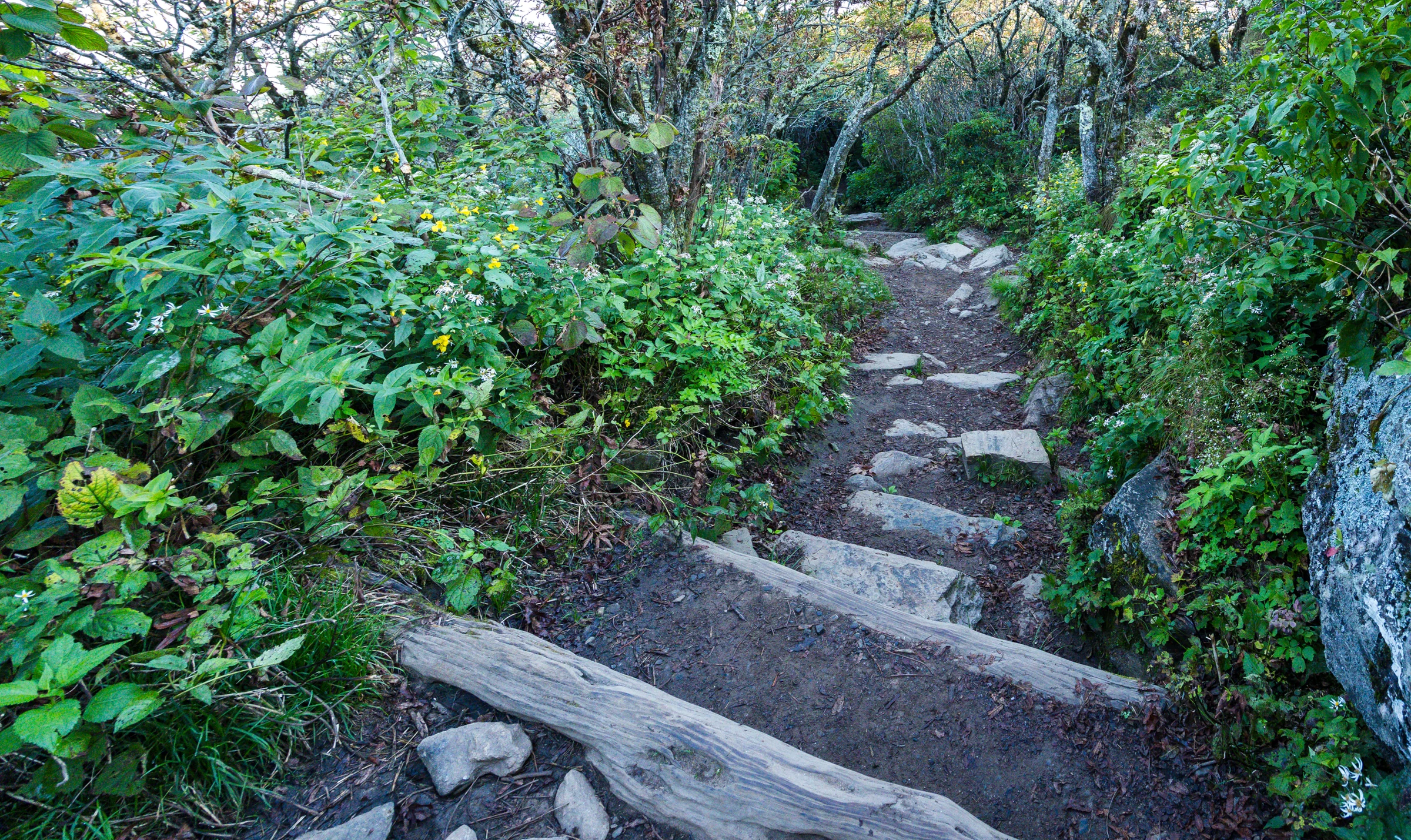
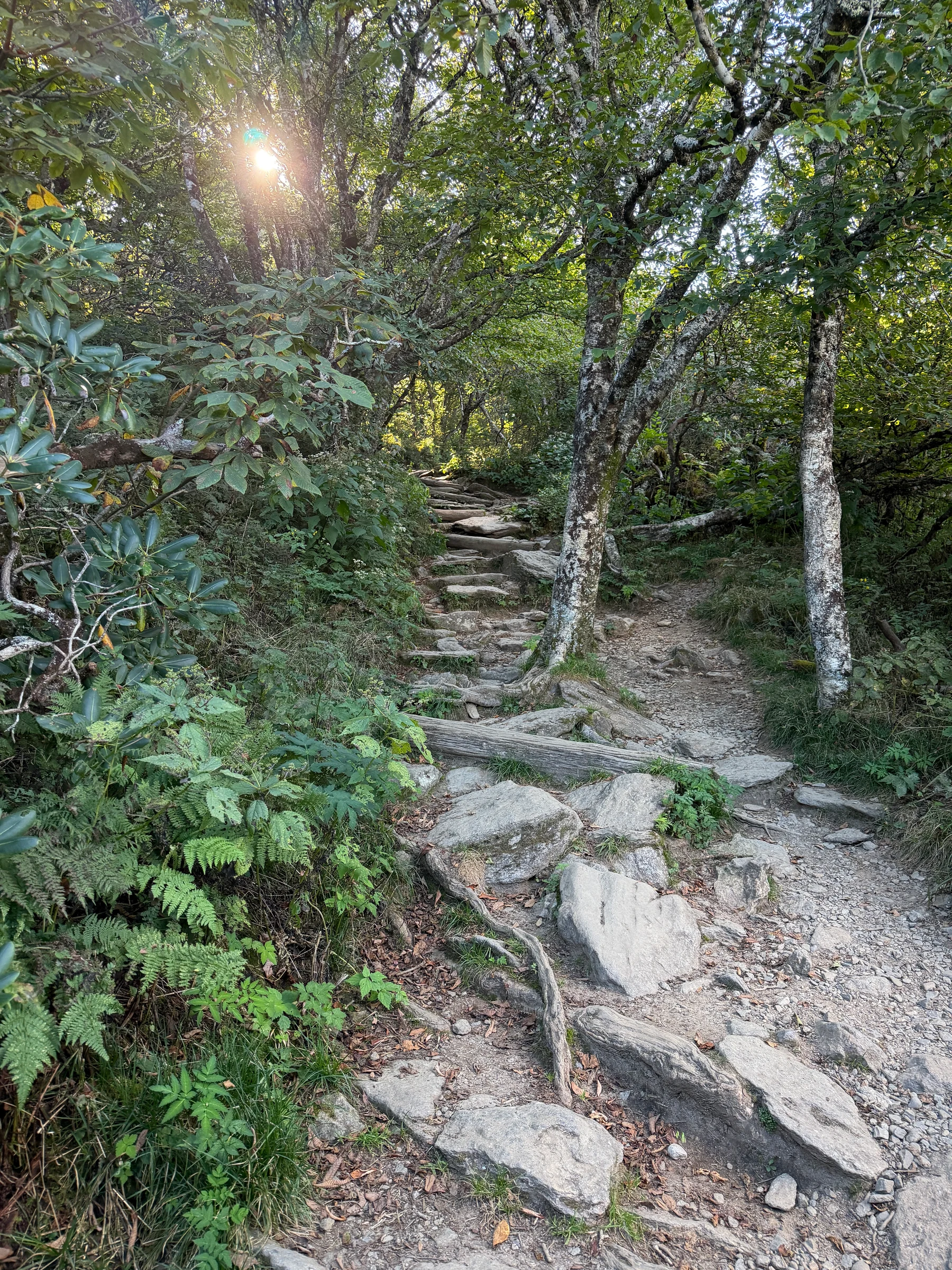
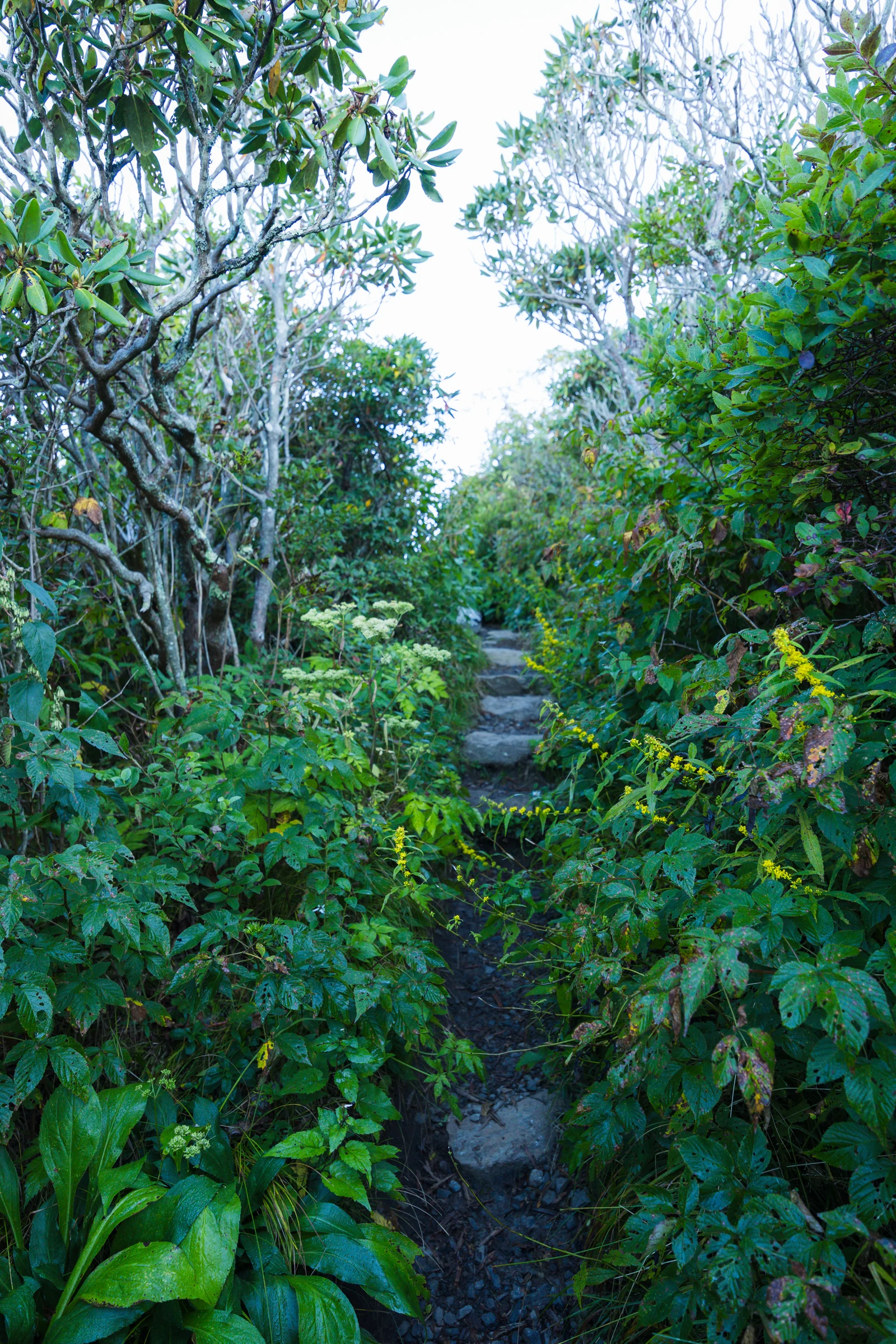
Please don't worry about the trail. It's short, it's rocky, and Julie walks you through every bit of it before the day.
"Let's go watch the sunset from Craggy" is one of the easiest proposal pretexts in Western North Carolina, because it's something people actually do. Sunrise takes more work. The ones that hold up: a sunrise hike you've been "meaning to do," a photographer friend who wants to shoot the inversion and invited you along, or, the simplest, a birthday or anniversary morning where getting up early is the gift.
At the summit we look like one more person with a camera, because there's always one more person with a camera. At the west ledge we're tucked into the rhododendron behind you, and you'll hear us before your partner sees us. At the lower overlook we can shoot from the trail above. On the call we'll agree on a signal, and we'll have been in position for a while before you arrive.
A very short trail, and a very rocky one. It climbs the whole way, with stone steps near the top. If you hike, be at the lot 20 minutes before your proposal time. If you don't, give it 30 to 45 minutes. If you'd like to take it easy, an hour gets you up with plenty of time to catch your breath, and there are some spectacular old trees on the way for stopping under. Julie goes over all of it with you.
Shoes with grip. The rock is polished from decades of feet and it's slick when wet, which is often. Most couples hike up in boots; Will scrambles around up here in hiking sandals with Vibram soles, but that's years of habit, and if you're not used to it, sturdy boots with ankle support are the right call. Bring the shoes you want in the photos and switch at the top. Plan on it being 10 to 15 degrees cooler than town and windier than you'd think, so bring a layer you can hand off before the moment and put back on after. Long dresses photograph beautifully up here and hike fine if you hold them on the steps. Heels don't.
If you're planning an outfit change for portraits afterward, know that there's nowhere to change up here except the woods. The rhododendron is thick enough for privacy most of the year; on a rhododendron weekend in June, change in the car before you walk up.
Keep it zipped, not in a loose pocket. The drop off the west ledge is into thick shrub and you'd get it back; the drop off the summit wall is not. Hand it to us on the walk up if you'd rather not carry it.
Cell coverage is good here: full signal at the lot, the summit, the lower overlook and the west ledge (that's AT&T; we haven't tested every carrier), with some dead stretches on the climb and in the tunnel. Good coverage means we can share locations, so a glance at your phone or watch shows exactly where we are and we can see where you are, without a single text. If your partner asks why you keep checking your phone, the answer is "checking the sunset time," which is true.
Seven hundred and fifty proposals and counting. Text Julie and we'll work out the spot, the timing and the cover story. Video is included, and your photos are back within 48 hours.
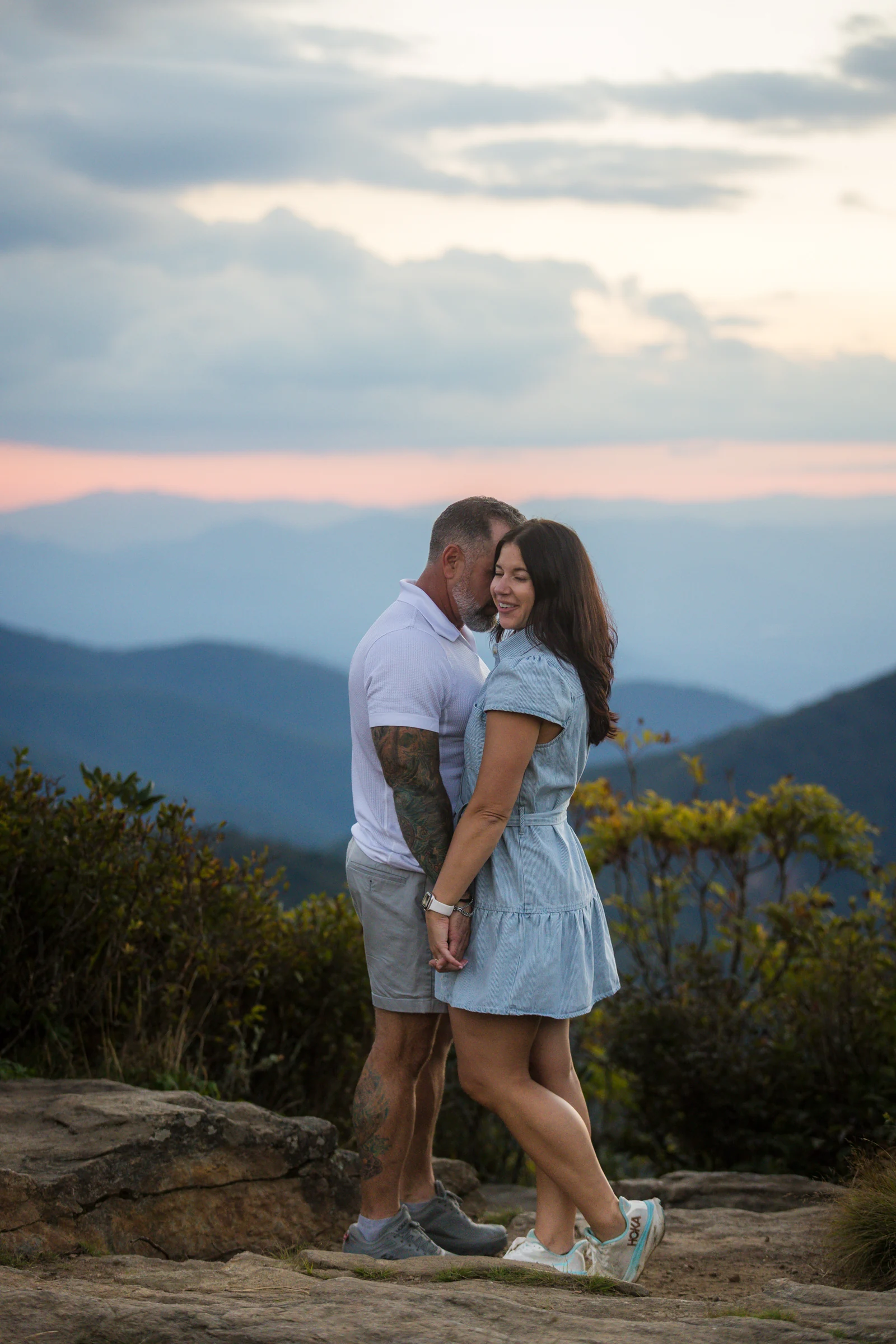
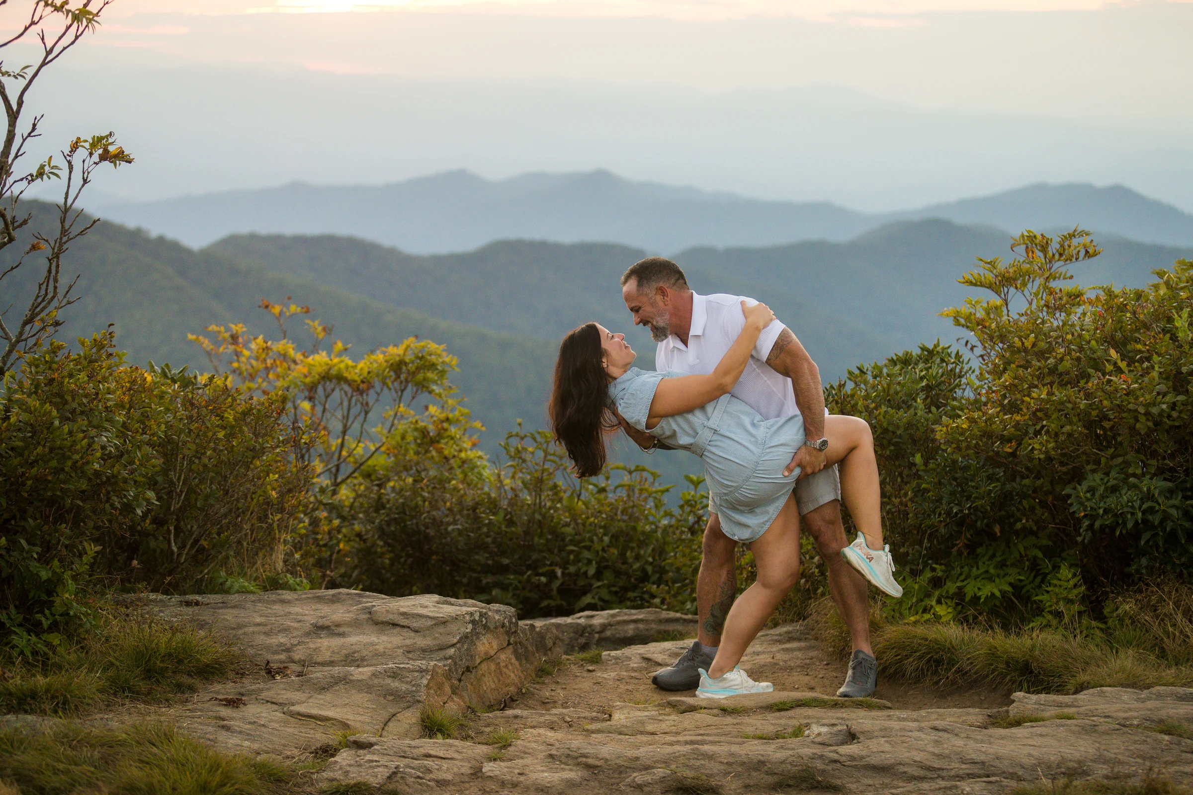
A real one, on the west ledge
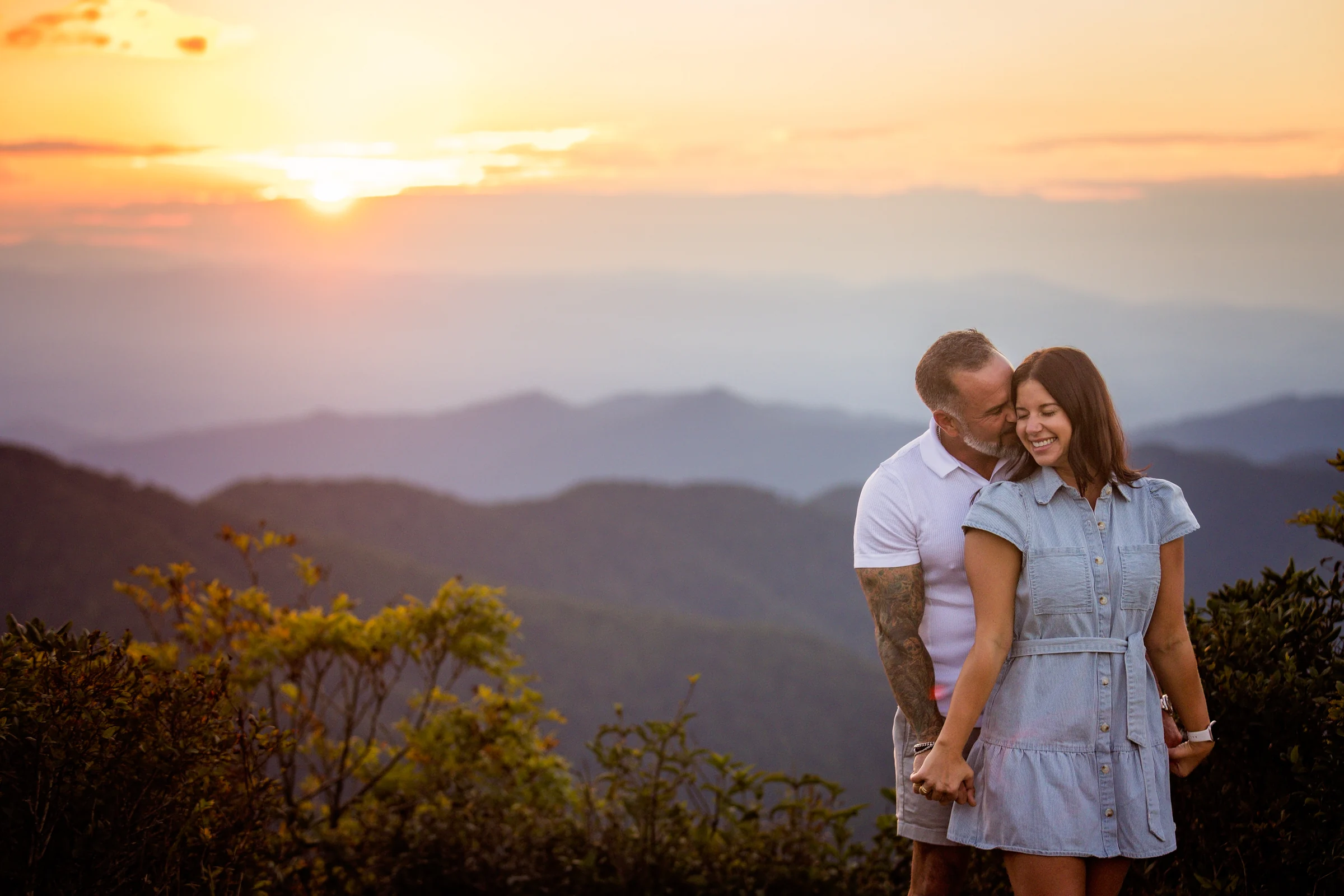
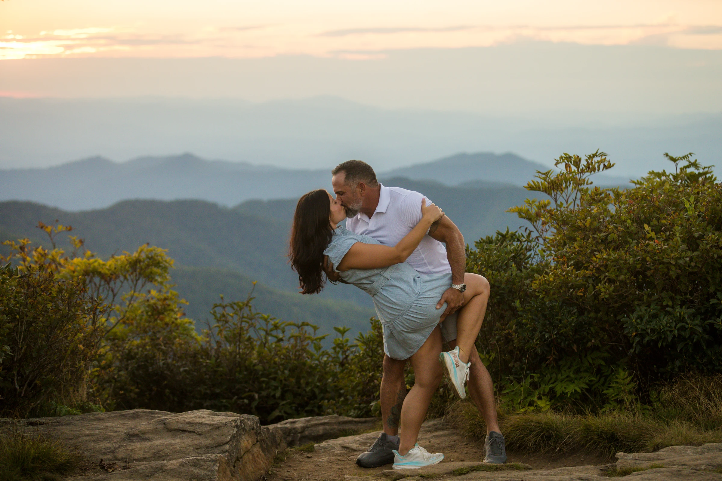
September 2026, the west ledge, one couple wide. We had a short window, a small piece of rock to work on, and light that swung between full shade and sunbursts with nothing in between. The full story, and the rest of the photographs, are in their own post.


Month by month
The mountain has a different look every six weeks, and none of them is the wrong one to propose in. Here's what to expect.
The Parkway usually reopens for good in April. The rhododendron is evergreen so the tunnels look the same as always, but the hardwoods below are still bare and the long views are at their clearest. Moody, quiet, and cold in the mornings.
The reason Craggy Gardens is famous. Dated records on this mountain going back to 2018 put the first open Catawba flowers anywhere from about May 24 to June 10 depending on the year, with the heaviest bloom in the first two weeks of June and the last flowers hanging on into the fourth week. In 2026 it ran early: full bloom by the last week of May, fading by June 12. Flame azalea and mountain laurel overlap the same window. This is also the busiest stretch of the year on weekends.
Green, lush, and the summer haze softens the ridges. Thunderstorms build in the afternoons and clear out for the evening; the sunsets after a storm are some of the best you'll see here. Wildflowers along the trail edges, and the bees are everywhere.
The heath bald is a blueberry patch, and the berries ripen from late July into August. You'll see people picking. You'll also see, on the approach road, a bear or two doing the same, most years. Goldenrod starts on the balds.
The mountain ash along the trail carries clusters of red-orange berries by September, and the first color shows in the high hardwoods around the middle of the month. Cool, clear high-pressure mornings begin, which means the inversions come back.
At this elevation color peaks in the first half of October, a week or two ahead of Asheville. It's a good year up here when the birch and mountain ash go gold against the evergreen rhododendron; it's a great year at the lower overlooks, where more of the view is hardwood. Weekends are the busiest of the year and the lot fills early.
Bare trees, long views, cold wind, and the first rime ice on the shrubs after a cold front. Gorgeous and underrated. The Parkway starts closing for ice late in the month.
The gates on this section close whenever ice forms in the tunnels, and at this elevation that's most of the winter. Figure an 80 percent chance you can't drive here in any given week. We'll happily plan a winter proposal with you; it just needs a backup location on a lower road.
Crowds
Anything you've read about Craggy crowds before 2024 describes a different mountain.
Hurricane Helene closed this section of the Parkway in September 2024 and it didn't reopen until September 2025. Since then the area has been noticeably quieter than the years before the storm, when summer weekends could feel like a festival. As of fall 2026 it's still quieter, and the 2026 repair traffic (dump trucks and one-lane control between Asheville and Mount Mitchell) has kept some casual visitors away.
That said, the mountain still fills on the weekends everyone knows about. Here's the year as we'd plan around it.
Weekends run two to three times busier than weekdays. Sunset draws a crowd 45 to 60 minutes before golden hour; sunrise draws a smaller one.
The naturalist's section
We're naturalists first, and part of why we love working on this mountain is that it doesn't look like anywhere else in the Southeast.
The Craggies are a heath bald: instead of forest, the summit is covered in a knee-to-head-high thicket of Catawba rhododendron, blueberry, mountain laurel and mountain ash, pruned by wind and ice into the gnarled shapes you walk through on the trail. It's the kind of plant community you'd otherwise have to go to the alpine zone of New England to see, and some of what grows here grows almost nowhere else.
The trail passes through arches of Catawba rhododendron, evergreen and twisted, so the walk-up photographs in every season, including bare April. In June the whole ridge goes purple. The flowers are why the Park Service named this place a garden.
The stunted hardwoods on the way up are mostly yellow birch, with pin cherry and American mountain ash mixed in. Look for the birch bark peeling in curls and, in September, the mountain ash's flat clusters of berries turning from yellow to red. In a good fall they go gold together.
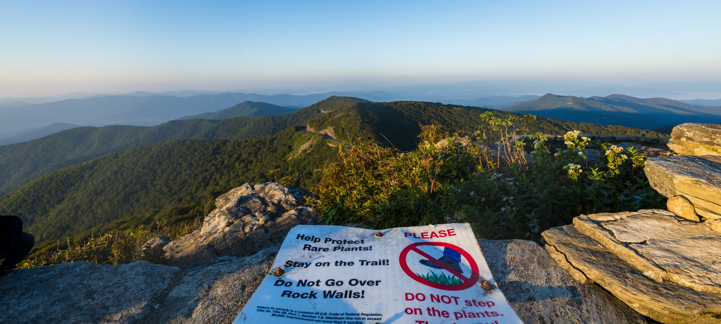
A handful of plants on these balds are found only in the high Southern Appalachians, some only on a few peaks. Two of them are named for this neighborhood: skunk goldenrod, which blooms along the trail edges in late summer, and mountain wood-aster, a small white heart-leaved aster of the high balds. Spreading avens, a federally endangered yellow flower, hangs on in rock crevices on a few of these summits. The Park Service used to keep quiet about where these grew. Now they're doing the opposite, putting up signs and stone walls where the plants are and asking people to stay on the trail so the rock ledges can recover. The three spots in this guide are all on the trail. There's no rare-plant reason not to use them, and no view you'll miss.
Ravens work the ridge most days, and in the breeding season the shrubs are full of chestnut-sided warblers. Black bears are a regular sight on the Parkway between Asheville and Craggy in late spring and summer, usually a sow with cubs grazing the road edge. You're far more likely to see one from the car than on the trail, and at this elevation the berry patches in August are theirs first.
Because this ridge sits in cloud so often, everything is wet more often than not: moss on the rock, lichen on the branches, the trail slick in spots that never see sun. It's part of why the place looks the way it does, and why the rock is polished. Good shoes, again.
Planning notes
The practical layer. We handle all of this with you on the planning call so there's nothing to think about on the day.
The Craggy Dome Overlook, milepost 364.1, on the Mount Mitchell side of the tunnel. Coming from Asheville you pass the visitor center, go through the tunnel, and the lot is immediately on the left. The trailhead is at the far end, with a sign. If the lot is full, the visitor center lot at 364.4 is the backup; the walk back to the trailhead is along the road and through the tunnel, which is short but unlit and has no sidewalk, so do it in daylight and single file.
As of September 2026 there are five portable toilets at the Pinnacle lot. The visitor center has real restrooms during its season, roughly May through October, and the picnic area's are closed with the picnic area. Permanent accessible toilets at both the visitor center and the Pinnacle lot are funded and planned; when they arrive we'll update this line.
The Park Service closes this stretch of the Parkway whenever ice forms, and there are physical gates. December through March, assume it's closed unless the road status page says otherwise. Check it the night before and the morning of, every time, in every season. The link is at the bottom of this page.
One thing most people don't know: a weather closure closes the road to cars, not to people. Cyclists and walkers can go around the gate, and some do, up roughly eleven miles of steady climbing from the Ox Creek Road gate. It's a serious ride, not something we can haul camera gear up, and not something we offer. If your date lands in gate season, the DuPont State Forest guide and Pretty Place are the lower-elevation spots we'd talk about first.
Through the end of 2026, heavy trucks are using the Parkway between Asheville and Mount Mitchell to reach landslide repair sites, with a 35 mph limit and intermittent one-lane control. Add 20 minutes to your drive. We add 30.
Full signal at the lot and at all three spots on AT&T; other carriers we haven't tested. The climb itself and the tunnel are spotty. Good enough for shared location, which is how we keep track of each other on the day.
Allowed on leash. The summit steps and the crowded wall are the tricky parts.
Staying on the trail
Craggy is a place that gets loved to death, and it's one of the few spots on the Parkway where rangers are out on the trail regularly, because they care about the plants up here. So do we. Some of the rock faces in older photos are now behind low stone walls or tape because the plants there are rare and were being trampled. We don't photograph on those, and you won't miss anything: the three spots above have the same views. If a climb-all-over-the-rocks proposal is what you're picturing, we'll point you to Black Balsam, where the rock is granite and nothing on it is endangered. Leave No Trace principles apply everywhere; here, staying on the trail is the whole of it. We go over this with you at the planning stage so there's nothing to think about on the day.
Across the road
From the summit, look across the Parkway to the rounded, rhododendron-covered hump to the east. That's Craggy Dome, at 6,062 feet the highest point in the Craggies and one of the forty-odd peaks over 6,000 feet in the Southern Appalachians. It has no official trail; the summit is reached by a short, steep, overgrown path from the Greybeard Mountain Overlook a couple of miles north on the Parkway, and it's a bushwhack near the top. Peak-baggers love it. It's not a proposal spot, and we don't take couples there, but if bagging a 6,000-footer together is your idea of a good engagement weekend, ask us. We may write it up.
FAQ
If yours isn't here, text it to Julie. It'll probably end up on this page.
Let's plan it
We're Will and Julie Thomas, Forge Mountain Photography. We've photographed more than 750 proposals across Western North Carolina over sixteen years, a lot of them on this trail, and we live 40 minutes away. Tell us your date and what you're picturing, and we'll tell you which spot, which hour, what the sky is likely to do, and how we'll stay out of sight until the moment. Video comes with every proposal, your photos are delivered within 48 hours, and family, friends and dogs are welcome. If you're aiming for a busy month, reach out sooner rather than later. Our work is used by Wikipedia and major reference platforms internationally, and every photo on this page is ours.
Still deciding on the mountain? Read the Max Patch proposal guide, the Black Balsam guide, the Max Patch elopement guide, or the DuPont State Forest proposal guide. Planning an engagement session here instead? The Craggy Gardens engagement guide covers the tunnel, the side ledges and the multi-spot routes.